DjangoCon US 2024
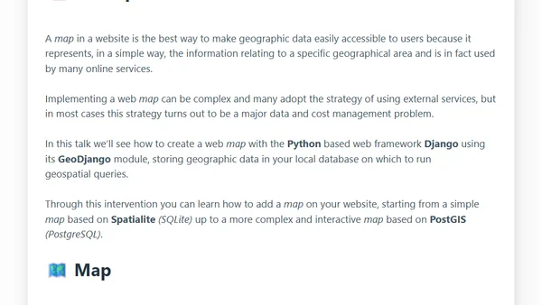
A talk from DjangoCon US 2024 on creating web maps using Django and its GeoDjango module, from simple to complex implementations.
Explores Django 5.0's new GeneratedField feature for database-calculated columns, focusing on practical examples with GeoDjango and PostGIS.
A software developer announces joining CARTO, a geospatial analysis and data science platform, to work on applications and open-source libraries.
A technical review of the Clickgis extension, which adds WKB and GeoJSON geospatial support to the ClickHouse database.
A talk from PyCon Italia 2023 on creating web maps using Django and its GeoDjango module, from simple Spatialite setups to complex PostGIS implementations.
A talk from PyCon DE 2023 on creating web maps using Django and its GeoDjango module, covering data storage and geospatial queries.
A talk on creating interactive web maps using Django's GeoDjango module with PostGIS, presented at Citus Con 2023.
Exploring DuckDB's geospatial extensions and features for optimizing a large-scale fiber-optic network data pipeline.
A talk from EuroPython 2022 on creating web maps using Django and its GeoDjango module, covering geospatial data storage and queries.
A technical guide on extracting Monaco's road network from OpenStreetMap, importing it into PostgreSQL/PostGIS, and rendering it with a tile server.
A talk on creating interactive web maps using Django and its GeoDjango module, covering geospatial data storage and queries.
A technical tutorial on creating interactive web maps using Django's GeoDjango module, PostGIS for spatial data, and the Leaflet JavaScript library.
A talk on creating web maps using Django and its GeoDjango module, covering geospatial data storage and queries from simple to complex implementations.
A talk on creating web maps using Django's GeoDjango module, from simple SQLite to complex PostGIS implementations.
A talk on creating web maps using Django and its GeoDjango module, covering geographic data storage and queries from simple to complex setups.
A talk on creating web maps with Django and GeoDjango, covering geographic data storage and geospatial queries from simple to complex implementations.
A technical guide on loading multiple geospatial shapefiles into a Postgres/PostGIS database using shell commands and data preparation techniques.
A developer's personal appreciation letter to PostgreSQL, reflecting on its evolution, robust features, and adaptability over the years.