The Streets of Monaco
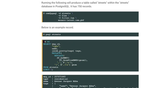
Read OriginalThis article provides a detailed technical tutorial on working with geospatial data. It covers extracting Monaco's road network from OpenStreetMap, importing it into a PostgreSQL database with the PostGIS extension, and setting up a minimalist tile server for rendering. It also mentions highlighting the Formula 1 circuit using a geospatial desktop application, including steps for installing software and compiling tools from source.
0 comments
Comments
No comments yet
Be the first to share your thoughts!
Browser Extension
Get instant access to AllDevBlogs from your browser
Top of the Week
1
The Beautiful Web
Jens Oliver Meiert
•
2 votes
2
When your coding agent doesn’t understand your project, you’ll get junk
Benjamin Cane
•
1 votes
3
LLM Use in the Python Source Code
Miguel Grinberg
•
1 votes
4
Wagon’s algorithm in Python
John D. Cook
•
1 votes
5
An example conversation with Claude Code
Dumm Zeuch
•
1 votes