Land Cover from Satellite Imagery
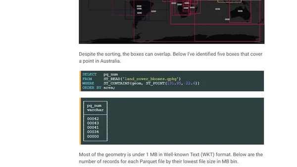
Read OriginalThis article details the process of working with Overture Maps' open global land cover vector dataset, derived from ESA satellite imagery. It explains how to identify regions, extract specific data (using Australia as an example), and set up a technical environment with tools like DuckDB, AWS CLI, and QGIS for geospatial analysis on a high-performance workstation.
0 comments
Comments
No comments yet
Be the first to share your thoughts!
Browser Extension
Get instant access to AllDevBlogs from your browser
Top of the Week
1
The Beautiful Web
Jens Oliver Meiert
•
2 votes
2
When your coding agent doesn’t understand your project, you’ll get junk
Benjamin Cane
•
1 votes
3
LLM Use in the Python Source Code
Miguel Grinberg
•
1 votes
4
Wagon’s algorithm in Python
John D. Cook
•
1 votes
5
An example conversation with Claude Code
Dumm Zeuch
•
1 votes