American Wind Farms
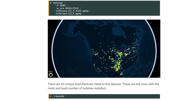
Read OriginalThis article details the process of downloading the U.S. Geological Survey's Wind Turbine Database, converting it to Parquet format, and performing a technical analysis. The author describes their workstation setup and uses tools like GDAL, DuckDB with extensions, and QGIS to process and visualize the geospatial data on wind farm locations and capabilities across the United States.
Comments
No comments yet
Be the first to share your thoughts!
Browser Extension
Get instant access to AllDevBlogs from your browser
Top of the Week
1
The Beautiful Web
Jens Oliver Meiert
•
2 votes
2
When your coding agent doesn’t understand your project, you’ll get junk
Benjamin Cane
•
1 votes
3
LLM Use in the Python Source Code
Miguel Grinberg
•
1 votes
4
Wagon’s algorithm in Python
John D. Cook
•
1 votes
5
An example conversation with Claude Code
Dumm Zeuch
•
1 votes