Quantifying changes of spatial patterns
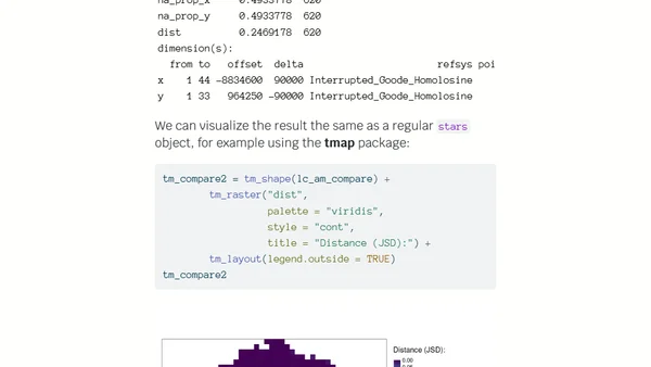
Read OriginalThis article presents a method for analyzing changes in spatial patterns, not just pixel values, using R. It demonstrates the process with land cover data from the Amazon, using the `motif` package's `lsp_compare()` function to identify areas with the most significant pattern changes between 1992 and 2018. It includes code for data download, visualization with `tmap`, and spatial signature comparison.
Comments
No comments yet
Be the first to share your thoughts!
Browser Extension
Get instant access to AllDevBlogs from your browser
Top of the Week
1
The Beautiful Web
Jens Oliver Meiert
•
2 votes
2
When your coding agent doesn’t understand your project, you’ll get junk
Benjamin Cane
•
1 votes
3
LLM Use in the Python Source Code
Miguel Grinberg
•
1 votes
4
Wagon’s algorithm in Python
John D. Cook
•
1 votes
5
An example conversation with Claude Code
Dumm Zeuch
•
1 votes